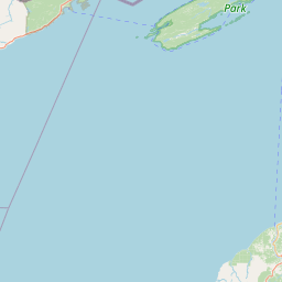
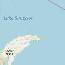
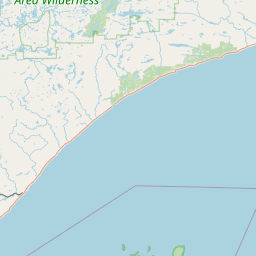
2016 USACE NCMP Topobathy Lidar DEM: Stamp Sands, Lake Superior (MI)
Data Set (DS) | OCM Partners (OCMP)GUID: gov.noaa.nmfs.inport:49436 | Updated: January 10, 2024 | Published / External
Summary
Short Citation
OCM Partners, 2025: 2016 USACE NCMP Topobathy Lidar DEM: Stamp Sands, Lake Superior (MI), https://www.fisheries.noaa.gov/inport/item/49436.
Full Citation Examples
These files contain rasterized, bare earth topobathy lidar elevations at a 1 m grid size, generated from data collected by the Coastal Zone Mapping and Imaging Lidar (CZMIL) system. CZMIL integrates a lidar sensor with simultaneous topographic and bathymetric capabilities, a digital camera and a hyperspectral imager on a single remote sensing platform for use in coastal mapping and charting activities. Horizontal positions, provided in decimal degrees of latitude and longitude, are referenced to the North American Datum of 1983 National Adjustment of 2011 (NAD83 NA11). Vertical positions are referenced to NAVD88 and provided in meters. The data file naming convention is based on the year, effort, area name, "Box" number and product type. An example file name is "2016_NCMP_MI_Superior_16TDT0423_BareEarth_1mGrid", where 2016 is the year of data collection, NCMP is the project under which data were collected, Michigan_Superior is the area of data collection, 16DT0423 is the "Box" number , and BareEarth 1mGrid is the product type. In addition to the bare earth DEMs, the topobathy lidar point data are also available. These data are available for download here: https://coast.noaa.gov/dataviewer/#/lidar/search/where:ID=5187 DEMs that were created from all classes of points (1, 2, 29) at a 1 meter grid size are available by request via email at: coastal.info@noaa.gov
Original contact information:
Contact Org: JALBTCX
Title: Data Production Manager
Phone: 228-252-1121
Email: JALBTCX@usace.army.mil
Distribution Information
-
Create custom data files by choosing data area, product type, map projection, file format, datum, etc.
-
Simple download of data files.
None. These data have been developed from the best available sources. Although efforts have been made to ensure that the data are accurate and reliable, errors and variable conditions originating from physical sources used to develop the data may be reflected in the data supplied. Users must be aware of these conditions and bear responsibility for the appropriate use of the information with respect to possible errors, scale, resolution, rectification, positional accuracy, development methodology, time period, environmental and climatic conditions and other circumstances specific to these data. The user is responsible for understanding the accuracy limitations of the data provided herein. The burden for determining fitness for use lies entirely with the user. The user should refer to the accompanying metadata notes for a description of the data and data development procedures.
These data depict the heights at the time of the survey and are only accurate for that time. Acknowledgement of the Joint Airborne Lidar Bathymetry Technical Center of eXpertise (JALBTCX) would be appreciated in any publications or derived products. The data herein, including but not limited to geographic data, tabular data, analytical data, electronic data structures or files, are provided "as is" without warranty of any kind, either expressed or implied, or statutory, including, but not limited to, the implied warranties or merchantability and fitness for a particular purpose. The entire risk as to the quality and performance of the data is assumed by the user. No guarantee of accuracy is granted, nor is any responsibility for reliance thereon assumed. In no event shall the U.S. Army Corps of Engineers, Mobile District Office, Spatial Data Branch be liable for direct, indirect, incidental, consequential or special damages of any kind, including, but not limited to, loss of anticipated profits or benefits arising out of use of or reliance on the data. The Spatial Data Branch does not accept liability for any damages or misrepresentation caused by inaccuracies in the data or as a result of changes to the data caused by system transfers or other transformations or conversions, nor is there responsibility assumed to maintain the data in any manner or form. Users should not use this data for critical applications without a full awareness of its limitations.
Controlled Theme Keywords
BATHYMETRY, COASTAL ELEVATION, COASTAL LANDFORMS, COASTAL PROCESSES, DOD/USARMY/USACE/SAM/MOBILE/OPJ/JALBTCX, elevation, imageryBaseMapsEarthCover, LAND USE CLASSES, oceans, SEAFLOOR TOPOGRAPHY, TERRAIN ELEVATION, TOPOGRAPHICAL RELIEF MAPS
Child Items
No Child Items for this record.
Contact Information
Point of Contact
NOAA Office for Coastal Management (NOAA/OCM)
coastal.info@noaa.gov
(843) 740-1202
https://coast.noaa.gov
Metadata Contact
NOAA Office for Coastal Management (NOAA/OCM)
coastal.info@noaa.gov
(843) 740-1202
https://coast.noaa.gov
Extents
2016-09-20