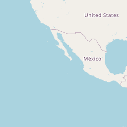
2004 Gulf of Mexico (AL,FL,LA,MS) IfSAR: Digital Elevation Model (DEM)
Data Set (DS) | OCM Partners (OCMP)GUID: gov.noaa.nmfs.inport:49442 | Updated: May 30, 2023 | Published / External
Summary
Short Citation
OCM Partners, 2025: 2004 Gulf of Mexico (AL,FL,LA,MS) IfSAR: Digital Elevation Model (DEM), https://www.fisheries.noaa.gov/inport/item/49442.
Full Citation Examples
Intermap DEMs populate its data store. The DEM products are generated using Intermap's STAR technology
(Interferometric Synthetic Aperture Radar). The system is mounted in an aircraft.
The Digital Terrain Model (DTM) data product was derived from the Digital Surface Model (DSM) using Intermap's
proprietory algorithm.
The DTM data for 7.5-minute by 7.5-minute units correspond to the USGS 1:24,000 scale topographic quadrangle map
series for areas in the United States and throughout the world. Each 7.5-minute by 7.5-minute DSM is comprised of
elevations at 5 meter postings. Each tile provides full coverage with overlap into adjacent tiles. Data for locations
above 56 degrees North/South are licensed in 7.5-minute by 15-minute tiles.
Original contact information:
Contact Org: NOAA Office for Coastal Management (OCM)
Phone: 843-740-1202
Email: coastal.info@noaa.gov
Distribution Information
No Distributions available.
Access Constraints:Purchase
End User License Agreement
Controlled Theme Keywords
imageryBaseMapsEarthCover
Child Items
| Type | Title |
|---|---|
| Entity | 5 meter posting grid cell |
Contact Information
Point of Contact
NOAA Office for Coastal Management (NOAA/OCM)
coastal.info@noaa.gov
(843) 740-1202
https://coast.noaa.gov
Metadata Contact
NOAA Office for Coastal Management (NOAA/OCM)
coastal.info@noaa.gov
(843) 740-1202
https://coast.noaa.gov
Extents


2004-01-01 - 2004-12-31