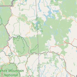
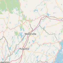
2007 U.S. Geological Survey Topographic Lidar: Augusta-Manchester, Maine
Data Set (DS) | OCM Partners (OCMP)GUID: gov.noaa.nmfs.inport:49787 | Updated: August 9, 2022 | Published / External
Summary
Short Citation
OCM Partners, 2025: 2007 U.S. Geological Survey Topographic Lidar: Augusta-Manchester, Maine, https://www.fisheries.noaa.gov/inport/item/49787.
Full Citation Examples
Lidar Contract No. 07CRCN0014
Lidar was collected at a 1.0 points per square meter (1.0m GSD) for the towns of Augusta and Manchester in Maine while no snow was on the ground and rivers were at or
below normal levels and prior to leaf-on conditions.
Distribution Information
-
Create custom data files by choosing data area, product type, map projection, file format, datum, etc.
-
Simple download of data files.
None
Users should be aware that temporal changes may have occurred since this data set was collected and some parts of this data may no longer represent actual surface conditions.
Users should not use this data for critical applications without a full awareness of its limitations. These data depict the heights at the time of the survey and are only
accurate for that time.
Controlled Theme Keywords
elevation
Child Items
No Child Items for this record.
Contact Information
Point of Contact
NOAA Office for Coastal Management (NOAA/OCM)
coastal.info@noaa.gov
(843) 740-1202
https://coast.noaa.gov
Metadata Contact
NOAA Office for Coastal Management (NOAA/OCM)
coastal.info@noaa.gov
(843) 740-1202
https://coast.noaa.gov
Extents
2006-10-10 - 2007-02-08