2007 Federal Emergency Management Agency (FEMA) New York Lidar: Niagara County
Data Set (DS) | OCM Partners (OCMP)GUID: gov.noaa.nmfs.inport:49882 | Updated: August 9, 2022 | Published / External
Summary
Short Citation
OCM Partners, 2025: 2007 Federal Emergency Management Agency (FEMA) New York Lidar: Niagara County, https://www.fisheries.noaa.gov/inport/item/49882.
Full Citation Examples
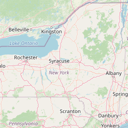
The spring 2007 LiDAR Flight Acquisition required the collection of approximately 526 square miles of Niagara County
and approximately 30 square miles of the corridors of Erie County. Total, approximately 555 square miles were collected
at a nominal point spacing of 1.4 meters and based on the Sanborn FEMA compliant LiDAR product specification.
The lidar data was collected from Jan 3 2007-May 9 2007. Multiple returns were recorded for each laser
pulse along with an intensity value for each return. The lidar points in this data set are the last return data, it is not a
bare earth data set and the points have not been classified.
LIDAR data is remotely sensed high-resolution elevation data collected by an airborne collection platform.
Using a combination of laser range finding, GPS positioning and inertial measurement technologies; LIDAR instruments
are able to make highly detailed Digital Elevation Models (DEM) of the earth's terrain, man-made structures and vegetation.
This data was collected at a resolution to aid in coastal management decisions including flood plain analysis and mapping.
Original contact information:
Contact Name: Jamie Young
Contact Org: Sanborn Mapping Company, Inc.
Title: General Manager
Phone: (719) 264-5602
Email: jyoung@sanborn.com
Distribution Information
-
Create custom data files by choosing data area, product type, map projection, file format, datum, etc.
-
Simple download of data files.
None
Users should be aware that temporal changes may have occurred since this data set was collected
and some parts of this data may no longer represent actual surface conditions. Users should not use this data for critical
applications without a full awareness of its limitations.
Controlled Theme Keywords
elevation
Child Items
No Child Items for this record.
Contact Information
Point of Contact
NOAA Office for Coastal Management (NOAA/OCM)
coastal.info@noaa.gov
(843) 740-1202
https://coast.noaa.gov
Metadata Contact
NOAA Office for Coastal Management (NOAA/OCM)
coastal.info@noaa.gov
(843) 740-1202
https://coast.noaa.gov
Extents


2007-01-03 - 2007-05-09