2016 USGS Lidar DEM: Yukon - Kuskokwim River Delta (AK)
Data Set (DS) | OCM Partners (OCMP)GUID: gov.noaa.nmfs.inport:52378 | Updated: January 10, 2024 | Published / External
Summary
Short Citation
OCM Partners, 2025: 2016 USGS Lidar DEM: Yukon - Kuskokwim River Delta (AK), https://www.fisheries.noaa.gov/inport/item/52378.
Full Citation Examples
Product: These are Digital Elevation Model (DEM) data for AK Yukon-Kuskokwim as part of the required deliverables for AK Yukon-Kuskokwim Lidar 2016 project. Class 2 (ground) lidar points in conjunction with the hydro breaklines and bridge breaklines were used to create a 1 meter hydro-flattened Raster DEM. Due to temporal issues related to tidally influenced streams within the AOI, water heights found in the interior of the project are occasionally higher than heights found along the coast. Occasionally, this will be evident in the digital elevation model.
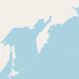
Geographic Extent: AOI is located in the Yukon-Kuskokwim River delta between the communities of Chevak and Newtok in Western Alaska. Additional satellite areas of interest are located neat the communities of Emmonak, Scammon Bay, and Mekoryuk Alaska. The areas of interest covers approximately 1,650 square miles.
Dataset Description: AK Yukon-Kuskokwim Lidar 2016 project called for the Planning, Acquisition, processing and derivative products of lidar data to be collected at a nominal pulse spacing (NPS) of 0.7 meter. Project specifications are based on the U.S. Geological Survey National Geospatial Program Base Lidar Specification, Version 1.2. The data was developed based on a horizontal projection/datum of NAD83, Universal Transverse Mercator, meters and vertical datum of NAVD88 (GEOID12B), meters. Lidar data was delivered as flightline-extent unclassified LAS swaths, as processed Classified LAS 1.4 files, formatted to 4877 individual 1000 m x 1000 m tiles as tiled Intensity Imagery, and as tiled bare earth DEMs; all tiled to the same 1000 m x 1000 m schema. Please note that delivery tiles 03VVH800710 and 03VWH110340 do not contain lidar points. The data boundary minimally intersects these tiles and a hydro breakline was digitized and subsequent DEM and Intensities TIFs were generated. There is no LAS 1.4 for tiles 03VVH800710 and 03VWH110340. The DEM IMG/Intensity tiff file count is 4879. The LAS 1.4 count is 4877.
Ground Conditions: Lidar was collected in late 2016 by Kodiak Mapping of Palmer Alaska , while no snow was on the ground and rivers were at or below normal levels. In order to post process the lidar data to meet task order specifications and meet ASPRS vertical accuracy guidelines, Kodiak Mapping established a total of 94 ground control points that were used to calibrate the lidar to known ground locations established throughout the project area. An additional 165 independent accuracy checkpoints, 117 in Bare Earth and Urban landcovers (117 NVA points), 48 in Tall Grass and Brushland/Low Trees categories (48 VVA points), were used to assess the vertical accuracy of the data. These checkpoints were not used to calibrate or post process the data.
The NOAA Office for Coastal Management (OCM) downloaded 4879 img files from the USGS site: ftp://rockyftp.cr.usgs.gov/vdelivery/Datasets/Staged/Elevation/OPR/AK_Yukon-Kuskokwim_2016/ and processed the data to be available on the Digital Coast Data Access Viewer (DAV).
In addition to these bare earth Digital Elevation Model (DEM) data, the lidar point data that these DEMs were created from, are also available. These data are available for custom download at the link provided in the URL section of this metadata record.
Breakline data are also available. These data are available for download at the link provided in the URL section of this metadata record. These products have not been reviewed by the NOAA Office for Coastal Management (OCM) and any conclusions drawn from the analysis of this information are not the responsibility of NOAA or OCM.
Distribution Information
-
Create custom data files by choosing data area, product type, map projection, file format, datum, etc.
-
Bulk download of data files in geographic coordinates, orthometric heights.
None
Users should be aware that temporal changes may have occurred since this data set was collected and some parts of this data may no longer represent actual surface conditions. Users should not use this data for critical applications without a full awareness of its limitations. Acknowledgement of the U.S. Geological Survey would be appreciated for products derived from these data.
Controlled Theme Keywords
COASTAL ELEVATION, elevation, TERRAIN ELEVATION
Child Items
No Child Items for this record.
Contact Information
Point of Contact
NOAA Office for Coastal Management (NOAA/OCM)
coastal.info@noaa.gov
(843) 740-1202
https://coast.noaa.gov
Metadata Contact
NOAA Office for Coastal Management (NOAA/OCM)
coastal.info@noaa.gov
(843) 740-1202
https://coast.noaa.gov
Extents


2016-08-30 - 2016-10-16
Aug 30, 31, Sept 1, 2, Oct 14, 15, 16, 2016