2017 Lidar: City of Palm Coast, FL
Data Set (DS) | OCM Partners (OCMP)GUID: gov.noaa.nmfs.inport:52733 | Updated: October 17, 2023 | Published / External
Summary
Short Citation
OCM Partners, 2025: 2017 Lidar: City of Palm Coast, FL, https://www.fisheries.noaa.gov/inport/item/52733.
Full Citation Examples
Digital Aerial Solutions LLC collected 185.5 square miles in the City of Palm Coast in Florida. The nominal pulse spacing for this project was 1 point every 0.35 meters. Dewberry used proprietary procedures to classify the LAS according to project specifications: 1-Unclassified, 2-Ground, 7-Low Noise, 9-Water, 10-Ignored Ground due to breakline proximity, 17- Overpasses and Bridges, 18-High Noise. Dewberry produced 3D breaklines and combined these with the final lidar data to produce seamless hydro flattened DEMs for the project area. The data was formatted according to the FDEM statewide tiling scheme with each tile covering an area of 5,000 ft by 5,000 ft. A total of 161 LAS tiles and 161 DEM tiles were produced for the entire project.
The NOAA Office for Coastal Management (OCM) received 161 las files from the City of Palm Coast, FL. OCM processed the data to be available on the Digital Coast Data Access Viewer (DAV).
In addition to these lidar point data, the bare earth hydro-flattened Digital Elevation Models (DEM) created from the lidar point data are also available. These data are are available for custom download at the link provided in the URL section of this metadata record.
Breakline data are also available. These data are are available for download at the link provided in the URL section of this metadata record. These products have not been reviewed by the NOAA Office for Coastal Management (OCM) and any conclusions drawn from the analysis of this information are not the responsibility of NOAA or OCM.
PurposeThe purpose of this lidar data was to produce high accuracy 3D elevation products, including tiled lidar in LAS 1.4 format, 3D breaklines, and 2.5 foot cell size hydro flattened Digital Elevation Models (DEMs). All products follow and comply with USGS Lidar Base Specification Version 1.2.
Distribution Information
-
Create custom data files by choosing data area, product type, map projection, file format, datum, etc. A new metadata will be produced to reflect your request using this record as a base.
-
LAS/LAZ - LASer
Bulk download of data files in LAZ format, geographic coordinates, orthometric heights. Note that the vertical datum (hence elevations) of the files here are different than described in this document.
None
This data was produced for the St. Johns River Water Management District according to specific project requirements. This information is provided "as is". Further documentation of this data can be obtained by contacting:
St. Johns River Water Management District, 4049 Reid Street, P.O. Box 1429, Palatka, Fl 32178-1429. Telephone (386) 329-4500.
Users should be aware that temporal changes may have occurred since this data set was collected and some parts of this data may no longer represent actual surface conditions. Users should not use this data for critical applications without a full awareness of its limitations.
Controlled Theme Keywords
COASTAL ELEVATION, TERRAIN ELEVATION
URLs
-
Information on the NOAA Office for Coastal Management (OCM)
-
The Data Access Viewer (DAV) allows a user to search for and download elevation, imagery, and land cover data for the coastal U.S. and its territories. The data, hosted by the NOAA Office for Coastal Management, can be customized and requested for free download through a checkout interface. An email provides a link to the customized data, while the original data set is available through a link within the viewer.
-
Link to data set report.
-
Link to custom download, from the Data Access Viewer (DAV), the raster Digital Elevation Model (DEM) data that were created from this lidar data set.
-
Link to download the breakline data.
Child Items
No Child Items for this record.
Contact Information
Point of Contact
NOAA Office for Coastal Management (NOAA/OCM)
coastal.info@noaa.gov
(843) 740-1202
https://coast.noaa.gov
Metadata Contact
NOAA Office for Coastal Management (NOAA/OCM)
coastal.info@noaa.gov
(843) 740-1202
https://coast.noaa.gov
Extents
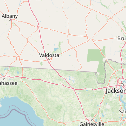
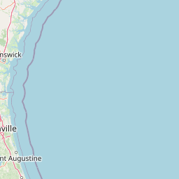
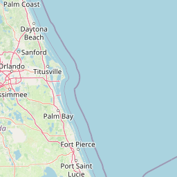
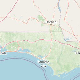


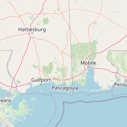

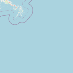

-81.381478° W,
-81.14499762° E,
29.65638572° N,
29.40842538° S
2017-03-28 - 2017-03-29