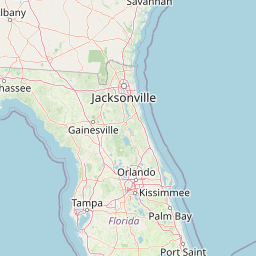
2013 Lidar DEM: St. Johns County, FL
Data Set (DS) | OCM Partners (OCMP)GUID: gov.noaa.nmfs.inport:55964 | Updated: January 10, 2024 | Published / External
Summary
Short Citation
OCM Partners, 2025: 2013 Lidar DEM: St. Johns County, FL, https://www.fisheries.noaa.gov/inport/item/55964.
Full Citation Examples
St. Johns County, Florida (County) has developed a comprehensive countywide base mapping and GIS enhancements to support master drainage planning, transportation planning, and preliminary engineering and wetland preservation studies. As part of this effort, Woolpert was contracted by Jones, Edmunds & Associates (JEA) to develop the new imagery and new DTM. The project consists of new 6-inch 4-Band Orthoimagery, new 1-meter max LiDAR, new 1-foot contours, updating of topographic/planimetric features. This data set is one component of a digital terrain model (DTM) for St. Johns County. The dataset is comprised of mass points, 2-D and 3-D breakline features, 1-foot and 2-foot contours, ground control, vertical test points, and a footprint of the data set, in the ESRI ArcGIS File Geodatabase format. In accordance with the counties specifications, the following breakline features are contained within the database: closed water bodies (lakes, reservoirs, etc) as 3-D polygons; linear hydrographic features (streams, shorelines, canals, swales, embankments, etc) as 3-D breaklines; coastal shorelines as 3-D linear features; edge of pavement road features as 3-D breaklines; soft features (ridges, valleys, etc.) as 3-D breaklines; island features as 3-D polygons; concretedam, culvert, footprint, lowconfidence, lowconfidenceanno, overpass, pipe, roadcenterlineoverbridge and swamppoint as 2-D features. Contours were generated from LiDAR ground class and breaklines and meet National Map Accuracy Standards. The LiDAR masspoints are delivered in the LAS file format based on the Florida statewide 5,000' by 5,000' grid. The GEOID model used to reduce satellite derived elevations to orthometric height is GEOID12A. Breakline features were captured to develop a hydrologically correct DTM. The coastalshoreline has a constant value of -0.6’ that was statistically derived from the LiDAR point cloud collected within the 2-hour window of MLL tide. 2008 Hydrographic and soft features were used to supplement the 2013 breaklines in Low Confidence areas.
The NOAA Office for Coastal Management (OCM) received the 5ft DEM data from St. Johns County GIS in March 2018 and processed the data to be available for download from the Data Access Viewer (DAV) and via https.
In addition to these bare earth Digital Elevation Model (DEM) data, the lidar point data that these DEM data were created from, are also available. These data are available for custom download at the link provided in the URL section of this metadata record.
Planimetric and breakline data are also available. These data are available for download at the link provided in the URL section of this metadata record. Please note that these products have not been reviewed by the NOAA Office for Coastal Management (OCM) and any conclusions drawn from the analysis of this information are not the responsibility of NOAA or OCM.
Distribution Information
-
Create custom data files by choosing data area, map projection, file format, datum, etc. A new metadata will be produced to reflect your request using this record as a base.
-
Bulk download of data files.
None
Users should be aware that temporal changes may have occurred since this data set was collected and some parts of this data may no longer represent actual surface conditions. Users should not use this data for critical applications without a full awareness of its limitations.
Controlled Theme Keywords
COASTAL ELEVATION, elevation, TERRAIN ELEVATION
Child Items
No Child Items for this record.
Contact Information
Point of Contact
NOAA Office for Coastal Management (NOAA/OCM)
coastal.info@noaa.gov
(843) 740-1202
https://coast.noaa.gov
Metadata Contact
NOAA Office for Coastal Management (NOAA/OCM)
coastal.info@noaa.gov
(843) 740-1202
https://coast.noaa.gov
Extents


2013-01-11
2013-01-12
2013-01-14
2013-01-17
2013-01-20
2013-01-22
2013-01-25