2015 FEMA Lidar: Michigan Part 2 (Alger, Benzie, Delta, Grand Traverse, Leelanau, Mackinac, Manistee Counties)
Data Set (DS) | OCM Partners (OCMP)GUID: gov.noaa.nmfs.inport:56300 | Updated: December 8, 2023 | Published / External
Summary
Short Citation
OCM Partners, 2025: 2015 FEMA Lidar: Michigan Part 2 (Alger, Benzie, Delta, Grand Traverse, Leelanau, Mackinac, Manistee Counties), https://www.fisheries.noaa.gov/inport/item/56300.
Full Citation Examples
The State of Michigan (DTMB) contracted with Sanborn to provide LiDAR mapping services for 13 counties in the State of Michigan. These counties include Alger, Allegan, Baraga, Benzie, Berrien, Delta, Emmet, Grand Traverse, Leelanau, Mackinac, Manistee, Marquette, and Van Buren. Utilizing multi-return systems, Light Detection and Ranging (LiDAR) data in the form of 3-dimensional positions of a dense set of mass points was collected for the 13 counties beginning in December 2014 through Fall 2015.
The Leica ALS70-HP (Sanborn) and ALS80-HP (subcontractor) were used to collect data for the survey campaign. Multiple airborne GPS (Global Positioning System) base stations were used in the Michigan LiDAR 2015 Project. These base stations were provided by Sanborn and subcontractors. The acquired LiDAR data was processed to all return point data. The last return data was further filtered to yield a LiDAR surface representing the bare earth.
This metadata record describes the Classified Point Cloud (LAS) for the 2015 FEMA Michigan LiDAR project. This data meets FEMA "Guidelines and Specifications for Flood Hazard Mapping Partners" and USGS Lidar Base Specification 1.0. Thirteen counties were collected in total, but separated into three parts. This record includes the counties in part 2.
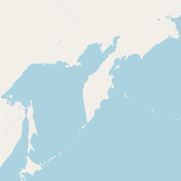
This metadata record includes information about these counties:
Alger - covers approximately 936 square miles
Benzie - covers approximately 347 square miles
Delta - covers approximately 1180 square miles
Grand Traverse - covers approximately 490 square miles
Leelanau - covers approximately 375 square miles
Mackinac - covers approximately 1187 square mile
Manistee - covers approximately 557 square miles
The NOAA Office for Coastal Management (OCM) downloaded the following laz files from this USGS site
ftp://rockyftp.cr.usgs.gov/vdelivery/Datasets/Staged/Elevation/LPC/Projects/ and processed the data to the Data Access Viewer (DAV) and to https:
USGS_LPC_MI_AlgerCo_2015_LAS_2017
USGS_LPC_MI_BenzieCo_2015_LAS_2016
USGS_LPC_MI_13CoDeltaC16_2015_LAS_2018
USGS_LPC_MI_GrandTraverseCO_2015_LAS_2017
USGS_LPC_MI_LeelanauCo_2015_LAS_2017
USGS_LPC_MI_MackinacCo_2015_LAS_2018
USGS_LPC_MI_ManisteeCo_2015_LAS_2017
Hydro breaklines are also available. These data are available for download at the link provided in the URL section of this metadata record. Please note that these products have not been reviewed by the NOAA Office for Coastal Management (OCM) and any conclusions drawn from the analysis of this information are not the responsibility of NOAA or OCM.
Distribution Information
-
Create custom data files by choosing data area, product type, map projection, file format, datum, etc. A new metadata will be produced to reflect your request using this record as a base.
-
LAS/LAZ - LASer
Bulk download of data files in LAZ format, geographic coordinates, orthometric heights. Note that the vertical datum (hence elevations) of the files here are different than described in this document.
None
Users should be aware that temporal changes may have occurred since this data set was collected and some parts of this data may no longer represent actual surface conditions. Users should not use this data for critical applications without a full awareness of its limitations.
Controlled Theme Keywords
COASTAL ELEVATION, elevation, TERRAIN ELEVATION
Child Items
No Child Items for this record.
Contact Information
Point of Contact
NOAA Office for Coastal Management (NOAA/OCM)
coastal.info@noaa.gov
(843) 740-1202
https://coast.noaa.gov
Metadata Contact
NOAA Office for Coastal Management (NOAA/OCM)
coastal.info@noaa.gov
(843) 740-1202
https://coast.noaa.gov
Extents


2015-04-17 - 2015-04-24
Grand Traverse County
2015-04-18 - 2015-04-30
Leelanau County
2015-04-24 - 2015-04-30
Benzie County
2015-04-24 - 2015-04-30
Manistee County
2015-05-05 - 2015-05-16
Mackinac County
2015-05-20 - 2015-05-30
Alger and Delta Counties