2017 TNRIS Lidar DEM: Jefferson, Liberty and Chambers, TX (East)
Data Set (DS) | OCM Partners (OCMP)GUID: gov.noaa.nmfs.inport:59008 | Updated: January 10, 2024 | Published / External
Summary
Short Citation
OCM Partners, 2025: 2017 TNRIS Lidar DEM: Jefferson, Liberty and Chambers, TX (East), https://www.fisheries.noaa.gov/inport/item/59008.
Full Citation Examples
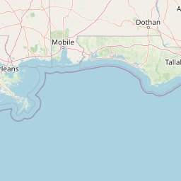
This metadata record describes the bare-earth hydro-flattened Digital Elevation Model (DEM) for the Eastern Block of the 2017 Texas Coastal LiDAR project. The Eastern Block covers approximately 841 square miles, including the cities of Beaumont, Port Arthur, and Nederland in southeast Texas. This point cloud AOI was collected to meet the density of 4 points per meter. The DEM has 1 m horizontal resolution, is in UTM Zone 15 projection, horizontal datum is the North American Datum of 1983 (NAD83 (2011)), vertical datum is North American Vertical Datum of 1988 (NAVD88) using the latest geoid (Geoid12b) for converting ellipsoidal heights to orthometric heights. Units - Meters
Sanborn Map Company was contracted by Texas Water Development Board (TWDB) in cooperation with the Trinity River Authority (TRA) to perform 2017 LiDAR aerial surveys of Texas coastal area of about 1130 square miles. Collections was completed utilizing multi-return systems, Light Detection and Ranging (LiDAR) data in the form of 3-dimensional positions of a dense set of mass points between February 22nd and March 23rd, 2017. ALS70 LiDAR was flown to produce four (4) points and eight (8) points per square meter return density or 0.5 meters and 0.35 meters respectively Nominal Point Spacing (NPS)
Note: The Western Block AOI covers approximately 289 square miles, including the cities of Liberty, Hankamer, and Anahuac in southeast Texas. This point cloud AOI was collected to meet the density of 8 points per meter. Total area covers equals approximately 1.130 square miles. The Western Block is available through the 'Related Items' section, below.
Distribution Information
-
Create custom data files by choosing data area, product type, map projection, file format, datum, etc.
-
GeoTIFF
Simple download of data files.
None
Users should be aware that temporal changes may have occurred since this data set was collected and some parts of this data may no longer represent actual surface conditions. Users should not use this data for critical applications without a full awareness of its limitations.
Controlled Theme Keywords
COASTAL BATHYMETRY, COASTAL ELEVATION, elevation, TERRAIN ELEVATION
Child Items
No Child Items for this record.
Contact Information
Point of Contact
NOAA Office for Coastal Management (NOAA/OCM)
coastal.info@noaa.gov
(843) 740-1202
https://coast.noaa.gov
Metadata Contact
NOAA Office for Coastal Management (NOAA/OCM)
coastal.info@noaa.gov
(843) 740-1202
https://coast.noaa.gov
Extents


2017-02-22 - 2017-03-04
Lidar acquisition dates