1986 -2019 USGS CoNED Topobathy DEM (Compiled 2020): Northern California
Data Set (DS) | OCM Partners (OCMP)GUID: gov.noaa.nmfs.inport:62987 | Updated: June 13, 2024 | Published / External
- View As
- View in Hierarchy
Summary
Short Citation
OCM Partners, 2025: 1986 -2019 USGS CoNED Topobathy DEM (Compiled 2020): Northern California, https://www.fisheries.noaa.gov/inport/item/62987.
Full Citation Examples
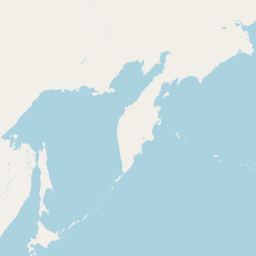
To support the modeling of storm-induced flooding, the USGS Coastal National Elevation Database (CoNED) Applications Project has created an integrated 1-meter topobathymetric digital elevation model (TBDEM) for the Northern California Coast. High-resolution coastal elevation data is required to identify flood, hurricane, and sea-level rise inundation hazard zones and other earth science applications, such as the development of sediment transport and storm surge models. This TBDEM consists of the best available multi-source topographic and bathymetric elevation data for the onshore and offshore areas in Northern California. The Northern California TBDEM integrates 26 different topographic and bathymetric data sources including LiDAR point clouds, hydrographic surveys, single-beam acoustic surveys, and multi-beam acoustic surveys obtained from USGS, NOAA, and USACE. The topographic and bathymetric surveys were sorted and prioritized based on survey date, accuracy, spatial distribution, and point density to develop a model based on the best available elevation data. Because bathymetric data are typically referenced to tidal datums (such as Mean High Water or Mean Low Water), all tidally-referenced heights were transformed into orthometric height based on a common geoid (Geoid09) that are normally used for mapping elevation on land based on the North American Vertical Datum of 1988. Every input data source in the TBDEM has been horizontally referenced to UTM Zone 10, NSRS2007. The spatial resolution is 1-meter with the general location ranging from the Golden Gate Bridge to the Oregon border, and extending inland to an elevation of at least +10 m and offshore to the 3-nautical-mile limit of California's State Waters. The overall temporal range of the input topography and bathymetry is 1986 to 2019. The topography surveys are from 2009-2019. The bathymetry is from 1986-2019. The nearshore void zone (not covered by lidar or sonar) was filled by interpolating points from adjacent datasets.
Distribution Information
-
Create custom data files by choosing data area, map projection, file format, etc. A new metadata will be produced to reflect your request using this record as a base.
-
GeoTIFF
Bulk download of data files in the original coordinate system.
None
Users should be aware that temporal changes may have occurred since this data set was collected and some parts of this data may no longer represent actual surface conditions. Users should not use this data for critical applications without a full awareness of its limitations.
Controlled Theme Keywords
COASTAL ELEVATION, elevation, environment, geoscientificInformation, oceans, SEAFLOOR TOPOGRAPHY, TERRAIN ELEVATION
Child Items
No Child Items for this record.
Contact Information
Point of Contact
NOAA Office for Coastal Management (NOAA/OCM)
coastal.info@noaa.gov
(843) 740-1202
https://coast.noaa.gov
Metadata Contact
NOAA Office for Coastal Management (NOAA/OCM)
coastal.info@noaa.gov
(843) 740-1202
https://coast.noaa.gov
Extents


1986-01-01 - 2019-01-01
Item Identification
| Title: | 1986 -2019 USGS CoNED Topobathy DEM (Compiled 2020): Northern California |
|---|---|
| Status: | Completed |
| Publication Date: | 2020-08-10 |
| Abstract: |
To support the modeling of storm-induced flooding, the USGS Coastal National Elevation Database (CoNED) Applications Project has created an integrated 1-meter topobathymetric digital elevation model (TBDEM) for the Northern California Coast. High-resolution coastal elevation data is required to identify flood, hurricane, and sea-level rise inundation hazard zones and other earth science applications, such as the development of sediment transport and storm surge models. This TBDEM consists of the best available multi-source topographic and bathymetric elevation data for the onshore and offshore areas in Northern California. The Northern California TBDEM integrates 26 different topographic and bathymetric data sources including LiDAR point clouds, hydrographic surveys, single-beam acoustic surveys, and multi-beam acoustic surveys obtained from USGS, NOAA, and USACE. The topographic and bathymetric surveys were sorted and prioritized based on survey date, accuracy, spatial distribution, and point density to develop a model based on the best available elevation data. Because bathymetric data are typically referenced to tidal datums (such as Mean High Water or Mean Low Water), all tidally-referenced heights were transformed into orthometric height based on a common geoid (Geoid09) that are normally used for mapping elevation on land based on the North American Vertical Datum of 1988. Every input data source in the TBDEM has been horizontally referenced to UTM Zone 10, NSRS2007. The spatial resolution is 1-meter with the general location ranging from the Golden Gate Bridge to the Oregon border, and extending inland to an elevation of at least +10 m and offshore to the 3-nautical-mile limit of California's State Waters. The overall temporal range of the input topography and bathymetry is 1986 to 2019. The topography surveys are from 2009-2019. The bathymetry is from 1986-2019. The nearshore void zone (not covered by lidar or sonar) was filled by interpolating points from adjacent datasets. |
| Purpose: |
As part of the vision for a 3D Nation, the USGS CoNED Applications Project is working collaboratively with the USGS National Geospatial Program, NOAA, and the USACE through the Interagency Working Group on Ocean and Coastal Mapping to build integrated elevation models in the coastal zone by assimilating the land surface topography with littoral zone and continental shelf bathymetry. The USGS CoNED Applications Project integrates disparate light detection and ranging (LiDAR) and bathymetric data sources into a common 3D database aligned both vertically and horizontally to a common reference system. CoNED Project TBDEM elevation model development is focused in select regions around the U.S. Coast, such as in the Northern Gulf of Mexico (NGOM), the Hurricane Sandy Region in the northeast, the California Coast Region, the Pacific Northwest, and the North Slope of Alaska. CoNED Project topobathymetric digital elevation models (TBDEMs) provide a required seamless elevation product for several science application studies such as shoreline delineation, coastal inundation mapping, sediment-transport, sea-level rise, storm surge models, tsunami impact assessment, and also to analyze the impact of various climate change scenarios on coastal regions. The raster elevation topobathymetric elevation product, the Federal Geographic Data Committee (FGDC) metadata, and the spatially referenced metadata are contained in the downloadable bundle. Spatially referenced metadata are contained within an ESRI geodatabase that contains footprints for each of the input source areas. References: Danielson, J.J., Poppenga, S.K., Brock, J.C., Evans, G.A., Tyler, D.J., Gesch, D.B., Thatcher, C.A., and Barras, J.A. , 2016, Topobathymetric elevation model development using a new methodology-Coastal National Elevation Database: Journal of Coastal Research, SI no. 76, p. 75-89, at http://dx.doi.org/10.2112/SI76-008. Thatcher, C.A., Brock, J.C., Danielson, J.J., Poppenga, S.K., Gesch, D.B., Palaseanu-Lovejoy, M.E., Barras, J.A., Evans, G.A., and Gibbs, A.E., 2016, Creating a Coastal National Elevation Database (CoNED) for science and conservation applications: Journal of Coastal Research, SI no. 76, p. 64-74, at http://dx.doi.org/10.2112/SI76-007. Gesch, Dean B., Oimoen, Michael J., and Evans, Gayla A., 2014, Accuracy assessment of the U.S. Geological Survey National Elevation Dataset, and comparison with other large-area elevation datasets-SRTM and ASTER: U.S. Geological Survey Open-File Report 2014-1008, 10 p., at http://dx.doi.org/10.3133/ofr20141008. Sugarbaker, L.J., Constance, E.W., Heidemann, H.K., Jason, A.L., Lukas, Vicki, Saghy, D.L., and Stoker, J.M., 2014, The 3D Elevation Program initiative—A call for action: U.S. Geological Survey Circular 1399, 35 p Carswell, W.J., Jr., 2013, The 3D Elevation Program—Summary for California: U.S. Geological Survey Fact Sheet 2013–3056, 2 p., http://pubs.usgs.gov/fs/2013/3056/. |
| Supplemental Information: |
The data obtained through ScienceBase at https://www.sciencebase.gov/catalog/item/5ebc4ba682ce25b51365d660 are considered to be the "best available" data from the USGS. For questions on distribution, please refer to the Distribution Section, Contact Information. For processing, please refer to the Data Quality Section, Processing Step, Contact Information. |
Keywords
Theme Keywords
| Thesaurus | Keyword |
|---|---|
| Global Change Master Directory (GCMD) Science Keywords |
EARTH SCIENCE > LAND SURFACE > TOPOGRAPHY > TERRAIN ELEVATION
|
| Global Change Master Directory (GCMD) Science Keywords |
EARTH SCIENCE > OCEANS > BATHYMETRY/SEAFLOOR TOPOGRAPHY > SEAFLOOR TOPOGRAPHY
|
| Global Change Master Directory (GCMD) Science Keywords |
EARTH SCIENCE > OCEANS > COASTAL PROCESSES > COASTAL ELEVATION
|
| ISO 19115 Topic Category |
elevation
|
| ISO 19115 Topic Category |
environment
|
| ISO 19115 Topic Category |
geoscientificInformation
|
| ISO 19115 Topic Category |
oceans
|
| UNCONTROLLED | |
| None | 3DEP |
| None | Acoustic Sonar |
| None | Coastal Marine and Geology Program |
| None | Coastal Zone |
| None | CoNED |
| None | DEM |
| None | Light Detection and Ranging |
| None | National Standards for Spatial Digital Accuracy |
| None | Topobathy |
| None | U.S. Geological Survey |
| None | USGS |
Spatial Keywords
| Thesaurus | Keyword |
|---|---|
| Global Change Master Directory (GCMD) Location Keywords |
CONTINENT > NORTH AMERICA > UNITED STATES OF AMERICA
|
| Global Change Master Directory (GCMD) Location Keywords |
VERTICAL LOCATION > LAND SURFACE
|
| Global Change Master Directory (GCMD) Location Keywords |
VERTICAL LOCATION > SEA FLOOR
|
| UNCONTROLLED | |
| Geographic Names Information System | Central Coastal California |
| Geographic Names Information System | County of Monterey |
| Geographic Names Information System | County of San Francisco |
| Geographic Names Information System | County of San Luis Obispo |
| Geographic Names Information System | County of San Mateo |
| Geographic Names Information System | County of Santa Barbara |
| Geographic Names Information System | County of Santa Cruz |
| Geographic Names Information System | State of California |
| U.S. Department of Commerce, 1987, Codes for the identification of the States, the District of Columbia and the outlying areas of the United States, and associated areas (Federal Information Processing Standard 5-2): Washington, D.C., National Instit | CA |
| U.S. Department of Commerce, 1995, Countries, dependencies, areas of special sovereignty, and their principal administrative divisions, Federal Information Processing Standard 10-4,): Washington, D.C., National Institute of Standards and Technology | U.S. |
| U.S. Department of Commerce, 1995, Countries, dependencies, areas of special sovereignty, and their principal administrative divisions, Federal Information Processing Standard 10-4,): Washington, D.C., National Institute of Standards and Technology | United States |
| U.S. Department of Commerce, 1995, Countries, dependencies, areas of special sovereignty, and their principal administrative divisions, Federal Information Processing Standard 10-4,): Washington, D.C., National Institute of Standards and Technology | USA |
Instrument Keywords
| Thesaurus | Keyword |
|---|---|
| Global Change Master Directory (GCMD) Instrument Keywords |
LIDAR > Light Detection and Ranging
|
Platform Keywords
| Thesaurus | Keyword |
|---|---|
| Global Change Master Directory (GCMD) Platform Keywords |
Airplane > Airplane
|
Physical Location
| Organization: | Office for Coastal Management |
|---|---|
| City: | Charleston |
| State/Province: | SC |
Data Set Information
| Data Set Scope Code: | Data Set |
|---|---|
| Data Set Type: | Elevation |
| Maintenance Frequency: | As Needed |
| Data Presentation Form: | raster digital data |
| Entity Attribute Detail Citation: |
USGS |
| Distribution Liability: |
Although these data have been processed successfully on a computer system at the USGS, no warranty expressed or implied is made by the USGS regarding the use of the data on any other system, nor does the act of distribution constitute any such warranty. Data may have been compiled from various outside sources. Spatial information may not meet National Map Accuracy Standards. This information may be updated without notification. The USGS shall not be liable for any activity involving these data, installation, fitness of the data for a particular purpose, its use, or analyses results. Any conclusions drawn from the analysis of this information are not the responsibility of NOAA, the Office for Coastal Management or its partners |
| Data Set Credit: | Please refer to the Data Quality Section, Source Citations for original source data information., Tyler, D.J. Danielson, J.J. Hockenberry, R.J. Beverly, S.D. U.S. Geological Survey (USGS) |
Support Roles
Data Steward
| Date Effective From: | 2020 |
|---|---|
| Date Effective To: | |
| Contact (Organization): | NOAA Office for Coastal Management (NOAA/OCM) |
| Address: |
2234 South Hobson Ave Charleston, SC 29405-2413 |
| Email Address: | coastal.info@noaa.gov |
| Phone: | (843) 740-1202 |
| URL: | https://coast.noaa.gov |
Distributor
| Date Effective From: | 2020 |
|---|---|
| Date Effective To: | |
| Contact (Organization): | NOAA Office for Coastal Management (NOAA/OCM) |
| Address: |
2234 South Hobson Ave Charleston, SC 29405-2413 |
| Email Address: | coastal.info@noaa.gov |
| Phone: | (843) 740-1202 |
| URL: | https://coast.noaa.gov |
Metadata Contact
| Date Effective From: | 2020 |
|---|---|
| Date Effective To: | |
| Contact (Organization): | NOAA Office for Coastal Management (NOAA/OCM) |
| Address: |
2234 South Hobson Ave Charleston, SC 29405-2413 |
| Email Address: | coastal.info@noaa.gov |
| Phone: | (843) 740-1202 |
| URL: | https://coast.noaa.gov |
Point of Contact
| Date Effective From: | 2020 |
|---|---|
| Date Effective To: | |
| Contact (Organization): | NOAA Office for Coastal Management (NOAA/OCM) |
| Address: |
2234 South Hobson Ave Charleston, SC 29405-2413 |
| Email Address: | coastal.info@noaa.gov |
| Phone: | (843) 740-1202 |
| URL: | https://coast.noaa.gov |
Extents
| Currentness Reference: | Ground Condition |
|---|
Extent Group 1
Extent Group 1 / Geographic Area 1
| W° Bound: | -124.5719 |
  |
|---|---|---|
| E° Bound: | -122.4453 | |
| N° Bound: | 42.0126 | |
| S° Bound: | 37.7702 |
Extent Group 1 / Time Frame 1
| Time Frame Type: | Range |
|---|---|
| Start: | 1986-01-01 |
| End: | 2019-01-01 |
Access Information
| Security Class: | Unclassified |
|---|---|
| Data Access Procedure: |
Data is available online for bulk or custom downloads |
| Data Access Constraints: |
None |
| Data Use Constraints: |
Users should be aware that temporal changes may have occurred since this data set was collected and some parts of this data may no longer represent actual surface conditions. Users should not use this data for critical applications without a full awareness of its limitations. |
Distribution Information
Distribution 1
| Start Date: | 2020-09-25 |
|---|---|
| End Date: | Present |
| Download URL: | https://coast.noaa.gov/dataviewer/#/lidar/search/where:ID=9181/details/9181 |
| Distributor: | NOAA Office for Coastal Management (NOAA/OCM) (2020 - Present) |
| File Name: | Customized Download |
| Description: |
Create custom data files by choosing data area, map projection, file format, etc. A new metadata will be produced to reflect your request using this record as a base. |
| File Type (Deprecated): | Zip |
| Compression: | Zip |
Distribution 2
| Start Date: | 2020-09-25 |
|---|---|
| End Date: | Present |
| Download URL: | https://noaa-nos-coastal-lidar-pds.s3.us-east-1.amazonaws.com/dem/CA_north_coned_DEM_2020_9181/index.html |
| Distributor: | NOAA Office for Coastal Management (NOAA/OCM) (2020 - Present) |
| File Name: | Bulk Download |
| Description: |
Bulk download of data files in the original coordinate system. |
| File Type (Deprecated): | GeoTIFF |
| Distribution Format: | GeoTIFF |
URLs
URL 1
| URL: | https://coast.noaa.gov/ |
|---|---|
| Name: | NOAA's Office for Coastal Management (OCM) website |
| URL Type: |
Online Resource
|
| File Resource Format: | HTML |
| Description: |
Information on the NOAA Office for Coastal Management (OCM) |
URL 2
| URL: | https://coast.noaa.gov/dataviewer/ |
|---|---|
| Name: | NOAA's Office for Coastal Management (OCM) Data Access Viewer (DAV) |
| URL Type: |
Online Resource
|
| File Resource Format: | HTML |
| Description: |
The Data Access Viewer (DAV) allows a user to search for and download elevation, imagery, and land cover data for the coastal U.S. and its territories. The data, hosted by the NOAA Office for Coastal Management, can be customized and requested for free download through a checkout interface. An email provides a link to the customized data, while the original data set is available through a link within the viewer. |
URL 3
| URL: | https://www.sciencebase.gov/catalog/item/5ebc4ba682ce25b51365d660 |
|---|---|
| Name: | Spatial Metadata |
| URL Type: |
Online Resource
|
| Description: |
Link to the USGS page for the topobathymetric model for Northern California. This page has a link to the spatial metadata in Esri gdb format. |
Technical Environment
| Description: |
Environment as of Metadata Creation: USGS Metadata Wizard 2.0.6 ; Esri ArcGIS 10.7.1 Service Pack N/A (Build N/A) |
|---|
Data Quality
| Horizontal Positional Accuracy: |
The horizontal accuracy for the integrated topobathymetric model was not assessed quantitatively. |
|---|---|
| Vertical Positional Accuracy: |
Integrated TBDEM Vertical Accuracy Assessment (GEOID09). The TBDEM root mean square error (RMSE) over the land area is 0.22 meters versus 40 NOAA NGS GPS bench mark control points distributed throughout the study area. |
| Completeness Report: |
Data set is considered complete for the information presented, as described in the abstract. Users are advised to read the rest of the metadata record carefully for additional details. |
| Conceptual Consistency: |
No formal logical accuracy tests were conducted. |
Lineage
Sources
2013 NOAA Coastal California TopoBathy Merge Project
| Publish Date: | 2013-10-30 |
|---|---|
| Extent Type: | Range |
| Extent Start Date/Time: | 2008 |
| Extent End Date/Time: | 2009 |
| Citation URL: | https://inport.nmfs.noaa.gov/inport/item/49649 |
| Source Contribution: |
Topographic, bathymetric, and acoustic elevation data along the entire California coastline. |
2015 USACE NCMP Topobathy Lidar: California
| Publish Date: | 2017-01-01 |
|---|---|
| Extent Type: | Discrete |
| Extent Start Date/Time: | 2015 |
| Citation URL: | https://noaa-nos-coastal-lidar-pds.s3.us-east-1.amazonaws.com/dem/USACE_CA_Topobathy_DEM_2015_8482/ |
| Source Contribution: |
Intermittent coverage (as determined by areas provided in pre-release request) between Point Sal and San Simeon Beach State Park. Only the bathymetric component of the dataset was included. |
Arena Cove Topobathy NOAA 10m
| Publish Date: | 2009-01-01 |
|---|---|
| Extent Type: | Discrete |
| Extent Start Date/Time: | 2009-01-01 |
| Citation URL: | https://www.ngdc.noaa.gov/mgg/coastal/coastal.html |
| Source Contribution: |
Arena Cove |
Bodega Bay Bathymetry
| Publish Date: | 2017-01-01 |
|---|---|
| Extent Type: | Discrete |
| Extent Start Date/Time: | 2017-01-01 |
| Citation URL: | https://www.arcgis.com/apps/opsdashboard/index.html#/4b8f2ba307684cf597617bf1b6d2f85d |
| Source Contribution: |
Bodega Bay. |
Bolinas Lagoon Bathymetry
| Publish Date: | 2016-01-01 |
|---|---|
| Extent Type: | Discrete |
| Extent Start Date/Time: | 2016-01-01 |
| Citation URL: | https://www.usgs.gov/centers/pcmsc/data-tools |
| Source Contribution: |
Bolinas Lagoon |
Crescent City Bathymetry
| Publish Date: | 2019-01-01 |
|---|---|
| Extent Type: | Discrete |
| Extent Start Date/Time: | 2019-01-01 |
| Citation URL: | https://www.arcgis.com/apps/opsdashboard/index.html#/4b8f2ba307684cf597617bf1b6d2f85d |
| Source Contribution: |
Crescent City |
Crescent City Topobathy NOAA 10m
| Publish Date: | 2010-01-01 |
|---|---|
| Extent Type: | Discrete |
| Extent Start Date/Time: | 2010-01-01 |
| Citation URL: | https://www.ngdc.noaa.gov/mgg/coastal/coastal.html |
| Source Contribution: |
Crescent City |
Drakes Estero Bathymetry
| Publish Date: | 1986-01-01 |
|---|---|
| Extent Type: | Discrete |
| Extent Start Date/Time: | 1986-01-01 |
| Citation URL: | http://pubs.er.usgs.gov/djvu/OFR/1991/ofr_91_145.djvu |
| Source Contribution: |
Drakes Estero |
Eel River Topobathy
| Publish Date: | 2014-01-01 |
|---|---|
| Extent Type: | Discrete |
| Extent Start Date/Time: | 2014-01-01 |
| Citation URL: | http://opentopo.sdsc.edu/datasetMetadata?otCollectionID=OT.122016.26910.1 |
| Source Contribution: |
Eel River. |
Eurkea Topobathy NOAA 10m
| Publish Date: | 2009-01-01 |
|---|---|
| Extent Type: | Discrete |
| Extent Start Date/Time: | 2009-01-01 |
| Citation URL: | https://www.ngdc.noaa.gov/mgg/coastal/coastal.html |
| Source Contribution: |
Eureka |
Fort Bragg Topobathy NOAA 10m
| Publish Date: | 2012-01-01 |
|---|---|
| Extent Type: | Discrete |
| Extent Start Date/Time: | 2012-01-01 |
| Citation URL: | https://www.ngdc.noaa.gov/mgg/coastal/coastal.html |
| Source Contribution: |
Fort Bragg. |
Humboldt Bay Lidar 2019
| Publish Date: | 2019-01-01 |
|---|---|
| Extent Type: | Discrete |
| Extent Start Date/Time: | 2019-01-01 |
| Citation URL: | https://coast.noaa.gov/dataviewer/#/lidar/search/where:ID=9026/details/9026 |
| Source Contribution: |
Humboldt Bay, Eureka. |
Humboldt Bay Sea Level Rise
| Publish Date: | 2014-01-01 |
|---|---|
| Extent Type: | Discrete |
| Extent Start Date/Time: | 2014-01-01 |
| Citation URL: | http://www.coastalecosystemsinstitute.org/humboldt-bay-slr-vulnerability-and-adaptation-planning/ |
| Source Contribution: |
Humboldt Bay. |
Klamath River Topobathy
| Publish Date: | 2018-01-01 |
|---|---|
| Extent Type: | Discrete |
| Extent Start Date/Time: | 2018-01-01 |
| Citation URL: | https://nationalmap.gov |
| Source Contribution: |
Klamath River |
Marin County Lidar
| Publish Date: | 2019-01-01 |
|---|---|
| Extent Type: | Discrete |
| Extent Start Date/Time: | 2019-01-01 |
| Citation URL: | https://gis.marinpublic.com/arcgis/rest/services/LIDAR |
| Source Contribution: |
Marin County. |
Mendocino County Lidar 2017
| Publish Date: | 2017-01-01 |
|---|---|
| Extent Type: | Discrete |
| Extent Start Date/Time: | 2017-01-01 |
| Citation URL: | https://nationalmap.gov |
| Source Contribution: |
Mendocino County. |
NOAA Bathymetry in raster (BAG) format
| Publish Date: | 2018-01-01 |
|---|---|
| Citation URL: | https://maps.ngdc.noaa.gov/viewers/bathymetry/ |
| Source Contribution: |
West of Golden Gate where other high-resolution bathymetry does not exist. Bathymetric Attributed Grids (BAGS) H12111 (2009), and H12112 (2009). Resolution varies from 1 m to 4 m. |
Northern California Wildfire Lidar
| Publish Date: | 2018-01-01 |
|---|---|
| Extent Type: | Discrete |
| Extent Start Date/Time: | 2018-01-01 |
| Citation URL: | https://nationalmap.gov |
| Source Contribution: |
Marin County, Northern Mendocino County, Southern Humboldt County |
Noyo River Bathymetry
| Publish Date: | 2018-01-01 |
|---|---|
| Extent Type: | Discrete |
| Extent Start Date/Time: | 2018-01-01 |
| Citation URL: | https://www.arcgis.com/apps/opsdashboard/index.html#/4b8f2ba307684cf597617bf1b6d2f85d |
| Source Contribution: |
Noyo River |
Rodeo Lagoon Bathymetry
| Publish Date: | 2006-01-01 |
|---|---|
| Extent Type: | Discrete |
| Extent Start Date/Time: | 2006-01-01 |
| Source Contribution: |
Rodeo Lagoon, Marin County. |
Russian River Bathymetry
| Publish Date: | 2009-01-01 |
|---|---|
| Extent Type: | Discrete |
| Extent Start Date/Time: | 2009-01-01 |
| Source Contribution: |
Lower Russian River. |
San Francisco Topobathy NOAA 10m
| Publish Date: | 2010-01-01 |
|---|---|
| Extent Type: | Discrete |
| Extent Start Date/Time: | 2010-01-01 |
| Citation URL: | https://www.ngdc.noaa.gov/mgg/coastal/coastal.html |
| Source Contribution: |
San Francisco. |
Sonoma County Lidar
| Publish Date: | 2013-01-01 |
|---|---|
| Extent Type: | Discrete |
| Extent Start Date/Time: | 2013-01-01 |
| Citation URL: | https://nationalmap.gov |
| Source Contribution: |
Sonoma County. |
USACE - Humboldt Bay
| Publish Date: | 2019-01-01 |
|---|---|
| Extent Type: | Discrete |
| Extent Start Date/Time: | 2019-01-01 |
| Citation URL: | https://www.arcgis.com/apps/opsdashboard/index.html#/4b8f2ba307684cf597617bf1b6d2f85d |
| Source Contribution: |
Humboldt Bay |
WA_El_NiNO_2016_USGS_CMHRP
| Publish Date: | 2016-01-01 |
|---|---|
| Extent Type: | Discrete |
| Extent Start Date/Time: | 2016-01-01 |
| Citation URL: | https://nationalmap.gov/,http://lidarportal.dnr.wa.gov/ |
| Source Contribution: |
Coastal California. |
Process Steps
Process Step 1
| Description: |
The principal methodology for developing the integrated topobathymetric elevation model can be organized into three main components. The "topographic component" consists of the land-based elevation data, which is primarily comprised from high-resolution LiDAR data. The topographic source data will include LiDAR data from different sensors (Topographic, Bathymetric) with distinct spectral wavelengths (NIR-1064nm, Green-532nm). The "bathymetric component" consists of hydrographic sounding (acoustic) data collected using boats rather than bathymetry acquired from LiDAR. The most common forms of bathymetry that are used include: multi-beam, single-beam, and swath. The final component, "Integration", encompasses the assimilation of the topographic and bathymetric data along the near-shore based on a predefined set of priorities. The land/water interface (+1 m- -1.5 m) is the most critical area, and green laser systems, such as the Experimental Advanced Airborne Research LiDAR (EAARL-B) and the Coastal Zone Mapping and Imaging LiDAR (CZMIL) that cross the near-shore interface are valuable in developing a seamless transition. The end product from the topography and bathymetry components is a raster with associated spatial masks and metadata that can be passed to the integration component for final model incorporation. Topo/Bathy Creation Steps: Topography Processing Component: a) Quality control check the vertical and horizontal datum and projection information of the input lidar source to ensure the data is referenced to NAVD88 and NAD83, UTM. If the source data is not NAVD88, transform the input LiDAR data to NAVD88 reference frame using current National Geodetic Survey (NGS) geoid models and VDatum. Likewise, if required, convert the input source data to NAD83 and reproject to UTM. b) Check the classification of the topographic LiDAR data to verify the data are classified with the appropriate classes. If the data have not been classified, then classify the raw point cloud data to non-ground (class 1) ground (class 2), and water (class 9) classes using LP360-Classify. c) Derive associated breaklines from the classified LiDAR to capture internal water bodies, such as lakes and ponds and inland waterways. Inland waterways and water bodies will be hydro-flattened where no bathymetry is present. d) Extract the ground returns from the classified LiDAR data and randomly spatial subset the points into two point sets based on the criteria of 95 percent of the points for the "Actual Selected" set and the remaining 5 percent for the "Test Control" set. The "Actual Selected" points will be gridded in the terrain model along with associated breaklines and masks to generate the topographic surface, while the "Test Control" points will be used to compute the interpolation accuracy (Root Mean Square Error) from the derived surface. e) Generate the minimum convex hull boundary from the classified ground LiDAR points that creates a mask that extracts the perimeter of the exterior LiDAR points. The mask is then applied in the terrain to remove extraneous terrain artifacts outside of the extent of the ground LiDAR points. f) Using a terrain model based on triangulated irregular networks (TINs), grid the "Actual Selected" ground points using breaklines and the minimum convex hull boundary mask at a 1-meter spatial resolution using a natural neighbor interpolation algorithm. g) Compute the interpolation accuracy by comparing elevation values in the "Test Control" points to values extracted from the derived gridded surface; report the results in terms of Root Mean Square Error (RMSE). |
|---|---|
| Process Date/Time: | 2020-04-28 00:00:00 |
Process Step 2
| Description: |
Bathymetry Processing Component: a) Quality control check the vertical and horizontal datum and projection information of the input bathymetric source to ensure the data is referenced to NAVD88 and NAD83, UTM. If the source data is not NAVD88, transform the input bathymetric data to NAVD88 reference frame using VDatum. Likewise, if required, convert the input source data to NAD83 and reproject to UTM. b) Prioritize and spatially sort the bathymetry based on date of acquisition, spatial distribution, accuracy, and point density to eliminate any outdated or erroneous points and to minimize interpolation artifacts. c) Randomly spatial subset the bathymetric points into two point sets based on the criteria of 95 percent of the points for the "Actual Selected" set and the remaining 5 percent for the "Test Control" set. The "Actual Selected" points will be gridded in the empirical bayesian kriging model along with associated masks to generate the bathymetric surface, while the "Test Control" points will be used to compute the interpolation accuracy (Root Mean Square Error) from the derived surface. d) Spatially interpolate bathymetric single-beam, multi-beam, and hydrographic survey source data using an empirical bayesian krigging gridding algorithm. This approach uses a geostatistical interpolation method that accounts for the error in estimating the underlying semivariogram (data structure - variance) through repeated simulations. e) Cross validation - Compare the predicted value in the geostatistical model to the actual observed value to assess the accuracy and effectiveness of model parameters by removing each data location one at a time and predicting the associated data value. The results will be reported in terms of RMSE. f) Compute the interpolation accuracy by comparing elevation values in the "Test Control" points to values extracted from the derived gridded surface; report the results in terms of RMSE. |
|---|---|
| Process Date/Time: | 2020-04-28 00:00:00 |
Process Step 3
| Description: |
Mosaic Dataset Processing (Integration) Component: a) Determined priority of input data based on project characteristics, including acquisition dates, cell size, retention of features, water surface treatment, visual inspection and presence of artifacts. b) Develop an ArcGIS geodatabase (Mosaic Dataset) and spatial seamlines for each individual topographic (minimum convex hull boundary) and bathymetric raster layer included in the integrated elevation model. c) Generalize seamline edges to smooth transition boundaries between neighboring raster layers and split complex raster datasets with isolated regions into individual unique raster groups. d) Develop an integrated shoreline transition zone from the best available topographic and bathymetric data to blend the topographic and bathymetric elevation sources. Where feasible, use the minimum convex hull boundary, create a buffer to logically mask input topography/bathymetry data. Then, through the use of TINs, interpolate the selected topographic and bathymetric points, if required, to gap-fill any near-shore holes in the bathymetric coverage. Topobathymetric LiDAR data sources such as the EAARL-B or CZMIL systems provide up-to-date, high-resolution data along the critical land/water interface within inter-tidal zone. e) Prioritize and spatially sort the input topographic and bathymetric raster layers based on date of acquisition and accuracy to sequence the raster data in the integrated elevation model. f) Based on the prioritization, spatially mosaic the input raster data sources to create a seamless topobathymetric composite at a cell size of 1 meter using blending (spatial weighting). g) Performed a visual quality assurance (Q/A) assessment on the output composite to review the mosaic seams for artifacts. h) Generate spatially referenced metadata for each unique data source. The spatially referenced metadata consists of a group of geospatial polygons that represent the spatial footprint of each data source used in the generation of the topobathymetric dataset. Each polygon is to be populated with attributes that describe the source data, such as, resolution, acquisition date, source name, source organization, source contact, source project, source URL, and data type (topographic LiDAR, bathymetric LiDAR, multi-beam bathymetry, single-beam bathymetry, etc.). |
|---|---|
| Process Date/Time: | 2020-04-28 00:00:00 |
Process Step 4
| Description: |
NOAA OCM retrieved the Topobathy DEM file from the USGS at the following link: https://www.sciencebase.gov/catalog/item/5ebc4ba682ce25b51365d660 That data were in UTM 10N, NAD83(NSRS2007) and NAVD88 heights using geoid09, with all units in meters. The data were in a single tiff file. To process to the Digital Coast, NOAA OCM used the gdal_retile python script to break the file into smaller tiles. Additionally, the gdal cloud_optimize python script was used to assign the geokeys and add compression. |
|---|---|
| Process Contact: | Office for Coastal Management (OCM) |
Catalog Details
| Catalog Item ID: | 62987 |
|---|---|
| GUID: | gov.noaa.nmfs.inport:62987 |
| Metadata Record Created By: | Blake Waring |
| Metadata Record Created: | 2020-09-25 14:34+0000 |
| Metadata Record Last Modified By: | Rebecca Mataosky |
| Metadata Record Last Modified: | 2024-06-13 15:29+0000 |
| Metadata Record Published: | 2024-01-10 |
| Owner Org: | OCMP |
| Metadata Publication Status: | Published Externally |
| Do Not Publish?: | N |
| Metadata Last Review Date: | 2020-09-25 |
| Metadata Review Frequency: | 1 Year |
| Metadata Next Review Date: | 2021-09-25 |