2021 Flowerfield Creek, MI Natural Color, Color Infrared and Hyperspectral Imagery
Data Set (DS) | Office for Coastal Management (OCM)GUID: gov.noaa.nmfs.inport:69219 | Updated: May 9, 2024 | Published / External
Summary
Short Citation
Office for Coastal Management, 2025: 2021 Flowerfield Creek, MI Natural Color, Color Infrared and Hyperspectral Imagery, https://www.fisheries.noaa.gov/inport/item/69219.
Full Citation Examples
Wild rice (Zizania palustris and Zizania aquatica), also known as manoomin, plays an integral role in the wetland ecosystems of the Great Lakes and is central to the culture, identity, and livelihood of Indigenous Peoples throughout the region. As manoomin faces increasing threats from climate change, land use change, pollution, invasive species, and other stressors, efforts are underway to protect and restore wild rice populations and habitat.
To support these efforts and help improve mapping and monitoring of wild rice in the Lake Michigan and Lake Huron basins, NOAA's Office for Coastal Management, in collaboration with tribal partners, identified twelve areas of interest (AOI) as pilot sites for airborne hyperspectral imagery and field data collection, which took place in August and September 2021.
In total, airborne hyperspectral imagery (with derived natural color and color infrared) was acquired for 43,493 acres. This imagery, in conjunction with field data and place-based knowledge and expertise of tribal partners, was used to help delineate ~13,775 acres of vegetated wetlands, including ~790 acres of wild rice.
AOI/Pilot Sites
1. Christiana Creek, MI
2. Fletcher Pond, MI
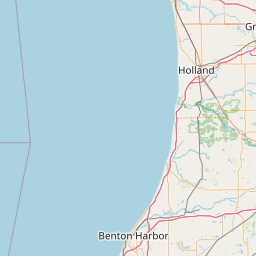
3. Flowerfield Creek, MI
4. French Farm Lake, MI*
5. Hamlin Lake, MI
6. Indiana Dunes, IN
7. Manistee River, MI
8. Miller Woods, IN
9. Nottawa Creek, MI
10. Potagannissing, MI
11. Rocky Creek, MI
12. Tawas Lake, MI
*To request imagery and associated vector and field data for this site, please contact:
Jon Mauchmar
Wildlife Technician
Little Traverse Bay Bands of Odawa Indians
Natural Resources Department - Inland Fish & Wildlife Program
Office: 231-242-1670
jmauchmar@ltbbodawa-nsn.gov
Distribution Information
-
Create custom data files by choosing area, map projection, file format, etc.
-
Simple download of data files.
For inquiries regarding access to the final report, classification vectors, and field data, including geotagged photos, field spectrometer readings, and stalk density measurements, please contact:
Jennifer Kanine, PhD, CWB
Director
Department of Natural Resources
(269) 782-9602 main; (269) 462-4214 desk
jennifer.Kanine@pokagonband-nsn.gov
Pokagon Band of Potawatomi
None. However, users should be aware that temporal changes may have occurred since this data set was collected and that some parts of this data may no longer represent actual surface conditions. Users should not use this data for critical applications without a full awareness of its limitations.
Controlled Theme Keywords
imageryBaseMapsEarthCover, INFRARED IMAGERY, VISIBLE IMAGERY
Child Items
No Child Items for this record.
Contact Information
Point of Contact
NOAA Office for Coastal Management (NOAA/OCM)
coastal.info@noaa.gov
(843) 740-1202
https://coast.noaa.gov
Metadata Contact
NOAA Office for Coastal Management (NOAA/OCM)
coastal.info@noaa.gov
(843) 740-1202
https://coast.noaa.gov
Extents
-85.77027777778° W,
-85.63388888889° E,
42.12666666667° N,
42.00194444444° S
2021-08-08