Biodiversity and Habitat Data Extracted from Video Files Recorded at Jarvis, Kingman, and Palmyra During July 2005 HURL Cruise
Data Set (DS) | Pacific Islands Fisheries Science Center (PIFSC)GUID: gov.noaa.nmfs.inport:8787 | Updated: February 13, 2025 | Published / External
Summary
Short Citation
Pacific Islands Fisheries Science Center, 2025: Biodiversity and Habitat Data Extracted from Video Files Recorded at Jarvis, Kingman, and Palmyra During July 2005 HURL Cruise, https://www.fisheries.noaa.gov/inport/item/8787.
Full Citation Examples
First reconnaissance at Jarvis Island, Palmyra Atoll, and Kingman Reef, Line Islands, for species diversity, community structure, deep-water habitats, and bottom topography of meso- and subphotic island slopes between 150-1027 m (mostly at 200-800 m) using Hawai`i Undersea Research Laboratory (HURL) PISCES research submersibles. Data were collected during July 2005 by Bruce Mundy, Frank Parrish, and James Maragos (USFWS), with major assistance with the staff of the Hawai`i Undersea Research Laboratory. Submersible dives were of 6-9 hours each: 1 at Jarvis Island, 2 at Palmyra Atoll, and 3 at Kingman Reef. Five of the dives used survey protocols from previous work in the Northwestern Hawaiian Islands, to allow comparisons with another region (one dive at Kingman Reef was purely exploratory). The protocol consisted of: (1) descent to a depth allowed by local conditions and time constraints; (2) exploratory observations upslope, (3) four 30 minute transects at 500, 450, 400, and 350 m during which observers identified, counted, and estimated the sizes of all fish and invertebrates with the aid of a calibrated laser scale projected on the substrate, and (4) more exploration upslope, if time allowed. Exploratory portions of the dives collected data on the species and habitat parameters observed, but did not include estimates of numbers or sizes of common organisms. Continuous audio and video files from the entire dives were recorded, from which data on biodiversity and habitat structure were extracted in the laboratory. Data analysis by Frank Parrish and Bruce Mundy.
Distribution Information
None
Child Items
| Type | Title |
|---|---|
| Entity | 2005_LINEISLAND_HURL_DATABASE |
| Entity | LINE_ISLAND_2005_HURL |
Contact Information
Point of Contact
Eva M Schemmel
eva.schemmel@noaa.gov
Extents


-165° W,
-160° E,
10° N,
-10° S
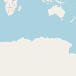
The Geographic Area for the data is the deepwater slopes of Jarvis Island (ca. 0.383 S, 160.0 W), Palmyra Atoll (ca. 5.867 N, 162.067 W), and Kingman Reef (6.4 N, 162.367 W ), Line Islands.
2005-07-01 - 2005-07-30
The start and end years for the data collected:
Survey start = 1 July 2005; end = 30 July 2005.